GIS
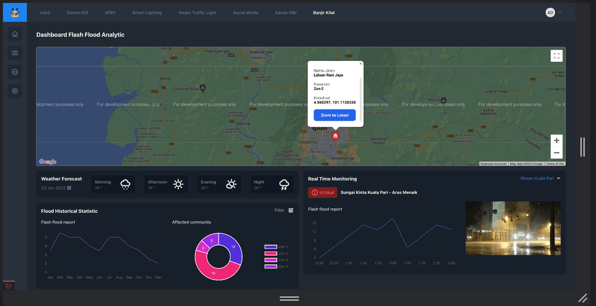
Flood Awareness Dashboard
A real-time dashboard that helps city councils monitor water levels and plan emergency responses.
Duration
4 months
Team Size
3
Location
Malaysia
Client
MBI
Key Features
Live Water Level Sensors
Flood Risk Heatmaps
Emergency Alert System
CCTV Integration
Challenges
Showing live sensor data without delays
Building a simple view for emergencies
Outcomes
Faster response times during flood events
Better data for future flood planning
Built With
Engineered using modern, scalable technologies
Vue.js
Maps
Laravel
Have a project in mind?
Let's talk about how we can help you build your vision and create something great together.